Planning Drawings in Croydon
Fixed-fee, MCIAT-chartered planning drawings for Croydon homeowners — Croydon Council validation and local constraints handled from the start.
Croydon is one of London's largest boroughs by population, running from the dense Victorian and Edwardian terraces of Thornton Heath, South Norwood and Addiscombe up to the generous interwar semi-detached and detached houses of Purley, Sanderstead and Coulsdon on the southern hills, with town-centre flats and larger homes in between. That range means the right project varies widely — a compact side-return in Addiscombe is a different exercise from a substantial double-storey extension on a large Purley plot — and the sloping sites across the southern hills further shape how an extension or lower-ground scheme is designed.
The suburban semis and detached homes toward Purley and Sanderstead often retain fuller permitted development rights than inner-London terraces, so larger rear and double-storey extensions can qualify, with the limit usually design and amenity policy rather than space. That said, the conservation areas of Addiscombe, South Norwood, Park Hill, Upper Norwood, Waddon and Sanderstead tighten design control where they apply, and Croydon's HMO Article 4 directions remove permitted development for change of use to an HMO (C3 to C4) in designated wards. We take a validation-first approach, checking the permitted development limits for your semi-detached or detached home — and confirming eligibility with a Lawful Development Certificate where it qualifies — before drawing.
We prepare Croydon planning drawings that use the available plot fully while respecting conservation control, producing the same council-accepted drawings an architect would across Croydon, Purley, Thornton Heath, Norbury and Coulsdon — usually at around 30% less. The fee is fixed and agreed up front, drawings typically turn around in about seven days, and we redraw free until Croydon approves. Most householder applications are determined within the statutory eight-week period once validated, so for a large borough spanning terraces to suburban plots a complete, correctly scaled submission to the council's checklist is the best way to avoid a validation query.
Planning in Croydon: what to know before you apply
Croydon applies Article 4 directions to HMO conversions in designated wards and controls office-to-residential change of use in parts of the town centre, alongside conservation-area design control in Addiscombe, South Norwood and Upper Norwood. The suburban semis and detached homes toward Purley and Sanderstead often retain fuller permitted development rights than inner-London terraces — we confirm before drawing.
Typical Croydon housing stock
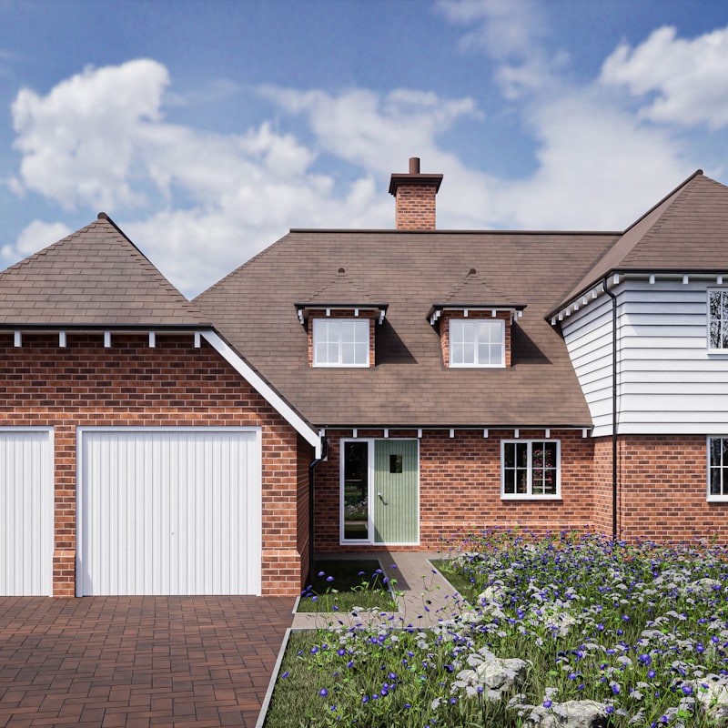
Interwar semi-detached suburbia across Purley, Sanderstead and Shirley, Victorian and Edwardian terraces through Thornton Heath, South Norwood and Addiscombe, and town-centre flats and larger detached houses toward the southern hills.
Areas we regularly draw for in Croydon
Croydon · Purley · Thornton Heath · South Norwood · Addiscombe · Sanderstead · Coulsdon · Norbury
What the numbers say about Croydon planning decisions
These are Croydon Council’s own reported figures, published by government rather than estimated by us. They are what we design against — a borough that refuses one householder application in five needs a different drawing package from one that refuses one in twenty.
Householder decisions in Croydon
Every householder application Croydon Council decided over the four quarters to 2026 Q1.
| Householder applications decided | 805 |
|---|---|
| Granted | 703 |
| Refused | 102 |
| GrantedEngland average 90% | 87% |
| Of which prior approvalsPrior approvals are granted far more often than full applications, so this share moves the rate above | 34% |
| Decided within 8 weeksExcludes prior approvals. England average 93% | 95% |
Source: Ministry of Housing, Communities and Local Government (PS2 district planning application statistics). Open Government Licence v3.0 Extracted 2026-08-16.
Permitted development in Croydon
Larger householder extensions put to Croydon Council under the prior-approval route, and lawful-development certificates decided, over eight quarters.
| Prior approval not requiredWent ahead without a full application | 155 |
|---|---|
| Prior approval granted | 143 |
| Prior approval refused | 56 |
| Granted where a decision was neededFrom 199 determinations | 72% |
| Building upwards, prior approval refused | 5 |
| Certificates of lawful development decided | 1,062 |
Source: Ministry of Housing, Communities and Local Government (PS1 district planning application statistics). Open Government Licence v3.0 Extracted 2026-08-16.
Designated areas in Croydon
Conservation areas Croydon Council has published to the national register, and when it designated them. Where a borough has supplied no Article 4 data the row is omitted rather than shown as zero.
| Conservation areas on the register | 20 |
|---|---|
| First designatedOf the 9 whose designation date the register records | 2,006 |
| Most recent designation | 2,008 |
Source: MHCLG Planning Data Platform. Open Government Licence v3.0 Extracted 2026-08-16.
If Croydon Council refuses: appeal outcomes
Planning appeals against Croydon Council determined by the Planning Inspectorate, 2021–2026. Enforcement notices and withdrawn cases are excluded.
| Appeals determined | 1,045 |
|---|---|
| Allowed | 260 |
| Dismissed | 785 |
| Householder appeals allowedFrom 289 householder appeals. England average 36% | 40% |
Source: Planning Inspectorate appeals casework. Open Government Licence v3.0 Extracted 2026-08-16.
Planning Drawings for Croydon homes: the package and the process
A planning set is judged as a set, not as individual sheets. Every existing drawing needs its proposed counterpart at the same scale and orientation so the officer can read the change at a glance, each sheet needs its own number, title, scale bar and north point, and the whole package needs to survive being printed at A3 without a dimension becoming illegible.
We draw to the conventions validation teams expect: plans and elevations at 1:100 or 1:50, a location plan at 1:1250 with the site edged red, a block plan at 1:500, and sections cut where the change in level or roof form actually happens rather than where they are easiest to draw.
The drawing list itself changes with the building. A detached house needs four elevations; a mid-terrace needs two plus a section through the party walls to show what is not visible from outside. Getting that list right at the start is what stops a validation officer asking for a sheet three weeks in.
What is included in a planning drawing set?
A council will only validate an application that contains the right drawings at the right scale. Our standard planning set covers everything a London validation team expects.
- Site location plan (1:1250) and block plan (1:500)
- Existing floor plans, elevations and sections
- Proposed floor plans, elevations and sections
- Roof plans where relevant, with heights and materials annotated
- A design and access or heritage statement where the borough requires one
How are planning drawings different from building regulations drawings?
Planning drawings show what the building will look like and how it sits in its context. Building regulations drawings show how it will be built safely — structure, insulation, fire escape and drainage. Most projects need both; our Complete package covers the two together with structural calculations coordinated in-house.
How quickly can you produce planning drawings in London?
After a laser survey, a standard householder set is typically ready within 7 days. We review every drawing against your borough's validation checklist before it reaches a planner's desk, which is why our first-time approval rate sits around 96%.
| Drawing | Typical scale | What it shows |
|---|---|---|
| Site location plan | 1:1250 | The property in its street context, site edged red |
| Block plan | 1:500 | The building's footprint and position in the plot |
| Floor plans (existing & proposed) | 1:100 / 1:50 | Room layout, walls, openings and the proposed changes |
| Elevations (existing & proposed) | 1:100 / 1:50 | Each face of the building and how it changes |
| Sections | 1:100 / 1:50 | A cut through showing heights, levels and roof form |

Planning Drawings across Croydon
Planning Drawings in Croydon — FAQs
What scale should London planning drawings be?+
Do I need an architect to produce planning drawings?+
How many revisions are included in the fee?+
Can you draw from my existing plans?+
Do planning drawings guarantee approval?+
Do I need planning permission for an extension in Croydon?+
Can I build a larger extension on a Purley or Sanderstead plot?+
What do Croydon's HMO Article 4 directions mean for me?+
How long does Croydon Council take to decide?+
How much do planning drawings cost in Croydon?+
Get your free Croydon planning assessment
Tell us your Croydon address and ambition — we'll confirm feasibility, local constraints and a fixed fee within one working day.