Measured Building Survey in North Kensington W10
Fixed-fee, MCIAT-chartered measured building survey for North Kensington (W10) homeowners — Royal Borough of Kensington and Chelsea validation and local constraints handled from the start.
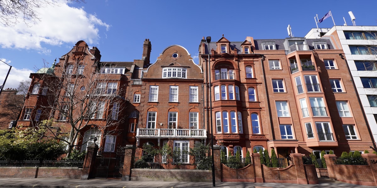
North Kensington (W10) in Kensington and Chelsea is a district of two halves. The Oxford Gardens conservation area covers a grid of late-Victorian terraces — some still whole houses, many subdivided into flats — while substantial post-war estates make up much of the rest, and Kensal Green Cemetery's landscape conservation area forms the northern edge.
Kensington and Chelsea layers its Article 4 directions more tightly than most boroughs, and two of them decide the shape of a typical W10 job. One covers basements, so the lower-ground excavation that is the borough's signature project needs a full planning application rather than permitted development. The other covers minor alterations in conservation areas including works to windows — which means something as modest as replacing windows on an Oxford Gardens frontage needs permission. A third removes permitted development rights for commercial to residential conversion. We establish which directions bite on an address, and whether it is a house or a flat, before drawing to the borough's guidance.
Planning in North Kensington (W10): what to know before you apply
W10 is covered by several Kensington and Chelsea Article 4 directions. One removes permitted development rights for basements, so excavation needs a full planning application. Another covers minor alterations in conservation areas including works to windows, so even window replacement on a protected frontage needs permission. A third removes permitted development rights for commercial to residential conversion. Two conservation areas apply — Oxford Gardens, covering the late-Victorian terrace grid, and Kensal Green Cemetery, protecting the landscape setting. Substantial parts of the district are post-war estate flats, which carry no permitted development rights at all.
Typical North Kensington housing stock
Late-Victorian terraces on the Oxford Gardens grid, a mix of whole houses and subdivided flats, set alongside substantial post-war estates and the open landscape of Kensal Green Cemetery to the north.
Streets we regularly draw for in North Kensington
Ladbroke Grove · Golborne Road · Oxford Gardens · St Quintin Avenue
What W10 is actually built of
Measured from 227 classified residential buildings in W10, not from a description of the area.
North Kensington W10 housing mix
Residential building form across the W10 postcode district, from 227 classified buildings.
| Attached on more than one side | 77% |
|---|---|
| Attached on one side | 20% |
| Detached | 3% |
| Median building footprint | 59 m² |
| Addresses per buildingAbove about 2 means flats and maisonettes dominate | 3.13 |
| Buildings classified | 227 |
Source: Ordnance Survey National Geographic Database (derived statistics). Contains OS data © Crown copyright and database right 2026. Contains Royal Mail data © Royal Mail copyright and database right 2026. Extracted 2026-08-17.
Measured Building Survey for North Kensington (W10) homes: the package and the process
A measured survey is the foundation every later drawing is checked against. We record the building as found — floor plans, elevations, sections, levels and, where needed, the position of structure and services — to a stated tolerance, so nothing downstream rests on an assumption about what is there.
The deliverable is chosen for what happens next. A conversion or extension design wants a layered CAD file that a designer can build on; a party wall or dilapidations matter wants dimensioned PDFs that stand on their own as a record. We agree that before the survey, because it changes what we capture.
Survey effort follows the building, not the floor area. A regular detached house measures quickly; a terrace with a rear outrigger, split levels, and a century of alterations takes longer because the survey has to record what was actually built rather than what the plan form implies.
Why does a planning or building regulations application need a measured survey?
A planning or building regulations application needs to show the existing building accurately alongside the proposed changes, so the council or Building Control can judge the impact of the work against what is actually there. Existing plans, elevations and sections drawn from an accurate measured survey give the borough confidence that the proposal has been designed against real dimensions, and give your builder a reliable set of drawings to price and build from — an application based on inaccurate or assumed dimensions risks queries, delays, or a design that does not translate cleanly on site.
What does a measured building survey capture?
The survey records everything needed to produce accurate existing drawings: internal room dimensions and floor-to-ceiling heights on every level, the position, width and height of every door and window, wall thicknesses, staircase dimensions and headroom, roof shape and pitch, chimney breasts and structural features, and the external footprint and boundary relationship of the property. Where relevant to the project, we also record ground levels, existing drainage runs and neighbouring boundary conditions.
This is captured with a laser distance meter rather than a tape measure, which keeps the survey accurate to within a few millimetres across a whole property and removes the cumulative measuring error that can creep into a hand-measured survey of a larger or more complex building.
Can I reuse an old survey or estate agent floor plan instead?
Generally, no — estate agent floor plans are produced for marketing purposes and are not dimensionally accurate enough to design an extension or loft conversion against, and a previous owner's drawings may not reflect alterations made since, or may simply be inaccurate to begin with. A fresh measured survey is a modest cost relative to the overall project and is the single best way to avoid a redesign once a builder is on site and finds the real dimensions differ from the drawings.
| Output drawing | Relies on the measured survey for |
|---|---|
| Floor plans | Accurate room dimensions and layout for sale, letting or lease use |
| Planning drawings | Existing plans, elevations and sections to compare against the proposal |
| Building regulations drawings | Accurate existing structure to design technical compliance against |
| Structural calculations | True spans, floor-to-ceiling heights and existing structural elements |

Measured Building Survey in North Kensington W10 — FAQs
How much does a measured building survey cost?+
How long does a measured survey take?+
Is a measured survey the same as a floor plan?+
Do I need a measured survey if I am only doing internal work?+
Can the survey be used for more than one purpose?+
Do I need planning permission for works in Kensington & Chelsea?+
Can I build a basement in Kensington & Chelsea?+
My home is listed — what consent do I need?+
How long does the Royal Borough take to decide?+
How much do planning drawings cost in Kensington & Chelsea?+
Get your free North Kensington planning assessment
Tell us your North Kensington (W10) address and ambition — we'll confirm feasibility, local constraints and a fixed fee within one working day.