Wraparound Extension Drawings in Canning Town E16
Fixed-fee, MCIAT-chartered wraparound extension drawings for Canning Town (E16) homeowners — London Borough of Newham validation and local constraints handled from the start.
Canning Town grew up as a working district beside the Royal Docks, home to dockworkers and heavy riverside industry before being heavily bombed in the Second World War and substantially rebuilt with post-war municipal estates. That layered history is why its streets today read so differently from one another, and why any drawings brief here starts with understanding which era a particular home belongs to.
No conservation area covers Canning Town; its planning character is instead shaped by one of London's largest ongoing regeneration programmes — the Canning Town & Custom House regeneration — together with high-density new development and the surviving mix of older stock. We treat that regeneration context, not a heritage designation, as the anchor when preparing planning and building-regulation drawings in E16.
In practice that means the approach flexes street by street: a modest interwar terrace on Hermit Road or Beaconsfield Road invites a fairly conventional rear or side-return extension, while a flat within a post-war estate or a newer apartment block raises tenure, party-wall and shared-structure questions first. As a chartered architectural technologist practice, we scope each Canning Town project against its real fabric and Newham's live policy rather than a template.
Planning in Canning Town (E16): what to know before you apply
Newham validates householder and full applications against its own local plan and the regeneration policy framework, so drawings should demonstrate a clear contextual response — scale, materials and impact on neighbours — for the specific block type. Because much of the stock is estate or new-build flats, expect tenure, leasehold consent and party-wall matters to sit alongside the planning submission, and confirm flood-zone status for riverside sites before design decisions are fixed.
Typical Canning Town housing stock
A genuinely mixed stock: modest interwar two-storey terraced houses that survived wartime bombing, post-war low- and medium-rise council estates rebuilt after the Blitz, and dense new-build apartment blocks and podium developments delivered through the ongoing regeneration. Extension and conversion potential varies sharply by block, so each site is assessed on its own tenure and structure.
Streets we regularly draw for in Canning Town
Hermit Road · Exning Road · Beaconsfield Road · Desford Road · Hilda Road · Chester Road · Durham Road · Addington Road · Cody Road · Clarence Road · Sycamore Close · Ordnance Road
What E16 is actually built of
Measured from 274 classified residential buildings in E16, not from a description of the area.
Canning Town E16 housing mix
Residential building form across the E16 postcode district, from 274 classified buildings.
| Attached on more than one side | 68% |
|---|---|
| Attached on one side | 27% |
| Detached | 4% |
| Median building footprint | 50 m² |
| Addresses per buildingAbove about 2 means flats and maisonettes dominate | 2.42 |
| Buildings classified | 274 |
Source: Ordnance Survey National Geographic Database (derived statistics). Contains OS data © Crown copyright and database right 2026. Contains Royal Mail data © Royal Mail copyright and database right 2026. Extracted 2026-08-17.
Wraparound Extension Drawings for Canning Town (E16) homes: the package and the process
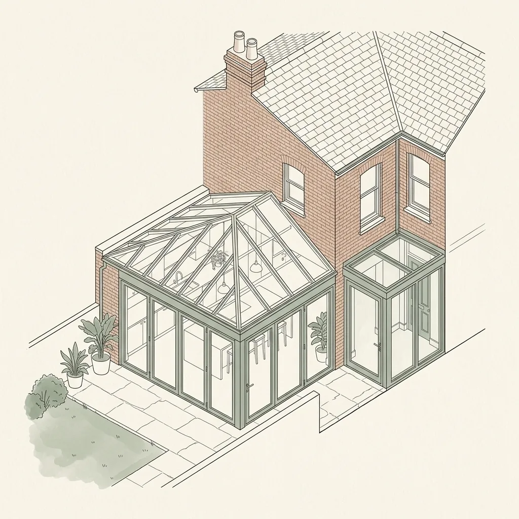
A wraparound is assessed as one addition, so the drawings have to present it as one: a single proposed footprint with the rear depth and the side width both dimensioned, the roof drawn as it turns the corner, and the remaining garden shown on the site plan.
The corner is where the technical work sits. Two roof planes and two structural spans meet at the return, drainage has to get round it, and the internal opening is usually wide enough to need a designed frame rather than a single beam. We resolve that junction on the drawings before it becomes a question on site.
A wraparound needs both a rear garden and a side alley, which in practice means a terrace or end-of-terrace with an outrigger. Where only one of the two exists, the honest answer is a rear extension or a side return — the combined footprint has nowhere to turn the corner.
What makes a wraparound extension different from a rear or side return alone?
A rear extension adds depth at the back of the house; a side return adds width down the alley; a wraparound does both at once, so the new floor area turns the corner of the original building rather than sitting against just one wall. The result is typically the largest open-plan space a single-storey extension can deliver, but it also means more of the original external wall is removed and more of the roof is new, which raises the structural and drainage stakes compared with either extension on its own. Homeowners who start out planning a rear extension or a side return alone often move to a wraparound once they see how little extra it costs to combine the two, since much of the groundwork, roof structure and glazing is shared between them rather than duplicated.
Do wraparound extensions need full planning permission in London?
Almost always, yes. Permitted development allowances are calculated on combined additions to the original house, and a wraparound's depth plus width together generally exceed the volume and footprint limits that apply to a rear extension or side extension considered separately. A Lawful Development Certificate route is rarely viable for a genuine wraparound.
Conservation area status and Article 4 directions, common across the terraced streets where wraparound extensions are most popular, remove permitted development rights further still, so we design every wraparound on the assumption it will go through full householder planning.
Structural design for a wraparound extension
Because the new space turns a corner, the structural frame has to work as one continuous system rather than two independent extensions bolted together.
- A continuous steel or ring-beam frame carrying the roof around the internal corner where the rear and side elements meet
- A glazed roof lantern or rooflight strip often placed at the corner junction, where natural light reaches deepest into the combined plan
- Foundations for both the rear and side elements designed together, so they tie into the existing house consistently
- Bi-fold or sliding doors across the rear elevation, coordinated with the side glazing so the two elements read as one space
| Route | What it covers | Typical fee |
|---|---|---|
| Full planning permission | Required for almost all wraparound extensions given the combined footprint | Full Planning pack ~£1,600–£2,400 |
| Planning + Building Regulations (structural) | Combined pack including structural calculations for the L-shaped frame and drainage diversion | Planning + Building Regs pack ~£2,200–£3,850 |
| Rear extension alone (comparison) | Smaller single-storey addition, may qualify for permitted development | see Rear Extension Drawings, from £1,100 |
| Side return alone (comparison) | Widens the kitchen only, keeps garden depth unchanged | see Side Return Extension Drawings, from £1,400 |

Wraparound Extension Drawings in Canning Town E16 — FAQs
How much does a wraparound extension cost to design in London?+
Does a wraparound extension always need planning permission?+
Do I need an architect for a wraparound extension?+
Will I need a Party Wall Agreement for a wraparound extension?+
How long does it take to get wraparound extension drawings?+
Is Canning Town in a conservation area?+
Can I extend a terraced house in Canning Town, E16?+
How long do planning drawings take for a Canning Town project?+
How long does Newham Council take to decide?+
Get your free Canning Town planning assessment
Tell us your Canning Town (E16) address and ambition — we'll confirm feasibility, local constraints and a fixed fee within one working day.