Planning Drawings in London | Council-Ready Sets
Existing and proposed plans, elevations and sections, formatted to your borough.
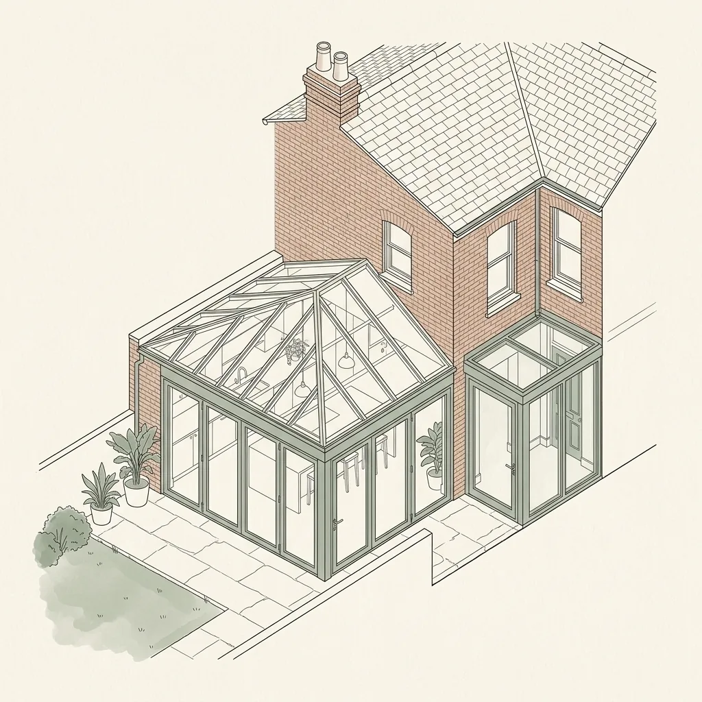
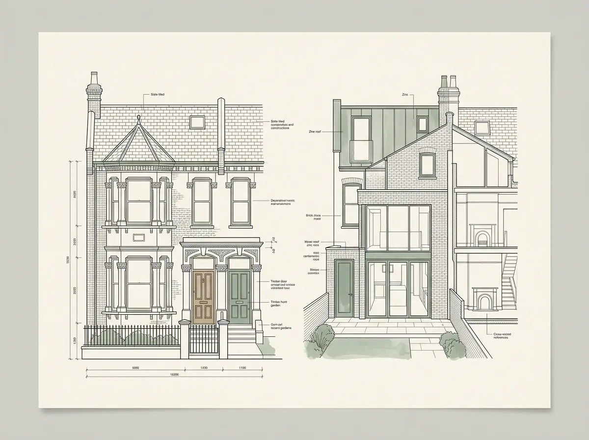
Planning drawings are the scale drawings a London council uses to judge your application: existing and proposed floor plans, elevations, sections and site plans that show the design, scale and neighbour impact of your project. DrawingsDirect produces complete, validation-ready planning drawing sets for extensions, lofts and conversions across London.
Fixed fees from £950 · Drawings in ~7 days · Free redraws to approval.
What is included in a planning drawing set?
A council will only validate an application that contains the right drawings at the right scale. Our standard planning set covers everything a London validation team expects.
- Site location plan (1:1250) and block plan (1:500)
- Existing floor plans, elevations and sections
- Proposed floor plans, elevations and sections
- Roof plans where relevant, with heights and materials annotated
- A design and access or heritage statement where the borough requires one
How are planning drawings different from building regulations drawings?
Planning drawings show what the building will look like and how it sits in its context. Building regulations drawings show how it will be built safely — structure, insulation, fire escape and drainage. Most projects need both; our Complete package covers the two together with structural calculations coordinated in-house.
How quickly can you produce planning drawings in London?
After a laser survey, a standard householder set is typically ready within 7 days. We review every drawing against your borough's validation checklist before it reaches a planner's desk, which is why our first-time approval rate sits around 96%.
What scale should planning drawings be for a London council?
London councils validate applications against a fixed set of drawings at prescribed scales, and getting the scale or format wrong is one of the commonest reasons a submission is returned before a planner ever sees it. Every borough works to the same core conventions, which we apply as standard.
- Site location plan at 1:1250, with the application site edged red and other land in your ownership edged blue
- Block or site plan at 1:500 showing the building's footprint within its plot
- Existing and proposed floor plans, elevations and sections at 1:100 or 1:50
- A north point, a scale bar and a unique drawing number on every sheet
- Metric dimensions, annotated materials and scaled PDFs to the borough's file standards
Why do London councils reject planning drawings?
Most returned applications fail on administration rather than design: a validation officer sends the submission back before a planner assesses it at all. The frequent culprits are a location plan at the wrong scale, existing and proposed drawings that don't correspond, a missing section, or elevations that ignore the neighbouring context.
We review every set against your borough's published validation checklist before submission, and because our proposed drawings are built directly on a laser survey of the existing building, the existing-and-proposed pair is always internally consistent — the discipline behind our roughly 96% first-time approval rate.
Can you produce a full planning set from a survey of my home?
Yes — a measured survey is the foundation of an accurate planning set. We laser-measure the property, model the existing building, then draw the proposed scheme on top so the two align exactly. If you already hold reliable measured drawings we can work from those, but for extensions and lofts a fresh survey removes the risk of a proposed drawing that cannot actually be built as shown.
| Drawing | Typical scale | What it shows |
|---|---|---|
| Site location plan | 1:1250 | The property in its street context, site edged red |
| Block plan | 1:500 | The building's footprint and position in the plot |
| Floor plans (existing & proposed) | 1:100 / 1:50 | Room layout, walls, openings and the proposed changes |
| Elevations (existing & proposed) | 1:100 / 1:50 | Each face of the building and how it changes |
| Sections | 1:100 / 1:50 | A cut through showing heights, levels and roof form |
Planning Drawings in your London borough
Local planning constraints, conservation areas and Article 4 notes for each council.
Complete your drawing package
Chartered planning drawings and application management for every London borough.Building Regulations Drawings
Full-plans construction packages with structural calculations, coordinated in-house.Architectural Drawings
The complete technical design service, from first concept to construction detail.
Planning Drawings — frequently asked questions
What scale should London planning drawings be?+
Do I need an architect to produce planning drawings?+
How many revisions are included in the fee?+
Can you draw from my existing plans?+
Do planning drawings guarantee approval?+
Ready for planning drawings that get approved?
Tell us your London address and project. We'll confirm feasibility and a fixed fee within one working day — with a free planning appraisal of your property's potential.